

Request Demo Izmir, Turkey  ·  +90 507 663 65 54
Features

Map Module

See the roof on the map before visiting the site

Overview

Preliminary Capacity on Satellite Imagery

The PVAGE Map Module is the workspace where roof and land areas are defined on satellite imagery, an initial panel capacity is derived, and the selected image is transferred to the design screens. It offers two working modes: 2D and 3D.
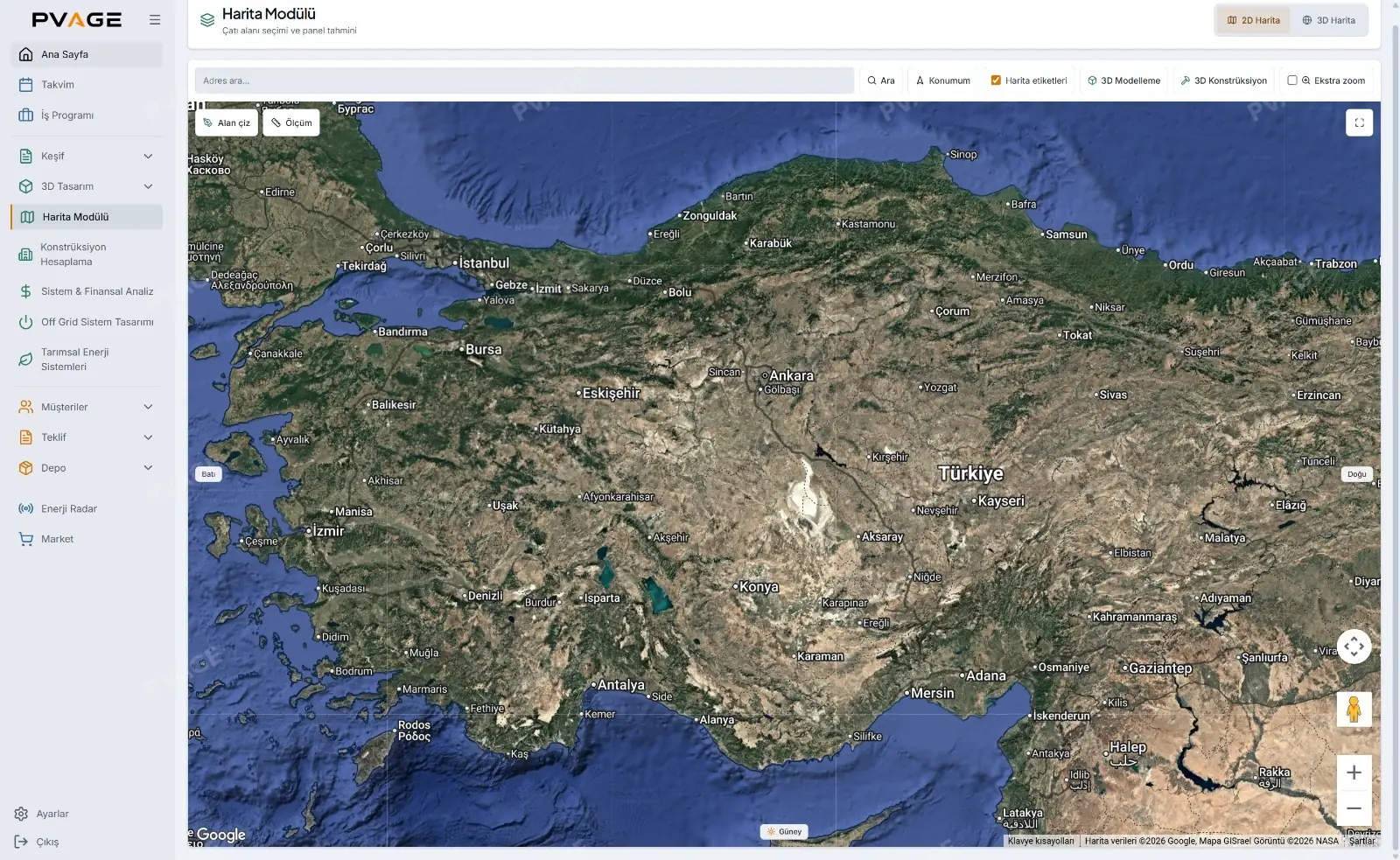
PVAGE map module screen
Capabilities

What You Can Do

Core Capabilities

  • 2D and 3D satellite maps — address search, current location and map labels
  • Multiple roof drawing — each roof on the same site is drawn and named separately
  • Measurement tool — distance between two points measured directly on the map
  • Usable area ratio — row spacing, edge safety margin, chimneys and walkways taken into account
  • Selection summary — total gross area, per-roof breakdown, estimated panel count and installed capacity
  • 3D terrain and building layers — three-dimensional view with adjustable building height
  • Hourly shade animation — shade movement tracked through the hours of the day
  • Transfer to design screens — the selected image is carried over to roof design and structure design
Business Value

Business Value

Initial capacity and installed power can be discussed in the first customer meeting, without a site visit. The need to climb onto the roof for measurements is removed at the early stage, and since the same image moves into the design, scale and framing do not need to be set up again.

More Features

More of What PVAGE Does

Ground-Mount Structure Design

Design platform arrays on real terrain elevation data for ground-mounted plants and take leg and profile quantities from the model.

Learn more

Shade Analysis

Add obstacles and surrounding structures, follow shadows by month and hour, and calculate panel-level shading loss.

Learn more

Mounting & Pre-Suitability

Mounting bill of materials by roof type, foundation sizing and a structural pre-suitability check.

Learn more

Production Forecast

Calculate location-specific monthly production with European Commission PVGIS satellite data and compare it with consumption.

Learn more
See all features
See It Live

Would You Like to See This Feature Live?

Try PVAGE with your own projects in a 7-day free demo; no credit card required.

Request Company Registration

Fill out the form and our team will contact you

+90

Notice: Once your request is approved, your login credentials will be sent to the phone number and email address you provided.

Request Received!

Our team will contact you shortly.

Schedule a Meeting

Fill out the form and let's set up your meeting

+90

Request Received!

Your meeting request has been received. Our team will contact you shortly.