

PVAGE's 3D modeling module lets you draw your roof or terrain to scale on satellite imagery or an uploaded photo and review it in three dimensions. Show your customers how the project will look after installation with a satellite-textured 3D scene, CAD view and drone tour.
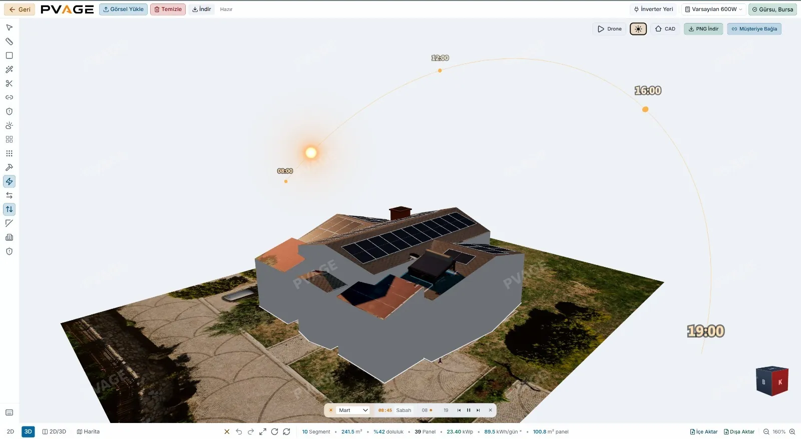
An image captured from the scene can be added to the proposal document, and the design can also be shared with the customer through a 3D link. Show your customers exactly how panels will look on their roof. A visual presentation makes the customer's decision process easier.
Advantage: You can share the 3D design with your customer through a link and let them explore the scene themselves.
After the panels are placed, the electrical design is done on the same roof; string connections are drawn as colored lines with plus/minus terminal labels.
Draw roof and land areas on 2D and 3D satellite maps and see estimated panel count and installed capacity without a site visit.
Learn moreDesign platform arrays on real terrain elevation data for ground-mounted plants and take leg and profile quantities from the model.
Learn moreAdd obstacles and surrounding structures, follow shadows by month and hour, and calculate panel-level shading loss.
Learn moreMounting bill of materials by roof type, foundation sizing and a structural pre-suitability check.
Learn moreTry PVAGE with your own projects in a 7-day free demo; no credit card required.
Fill out the form and our team will contact you
Our team will contact you shortly.
Fill out the form and let's set up your meeting
Your meeting request has been received. Our team will contact you shortly.